
LiDAR Is Changing Perspectives on Physical Systems
Measurement systems are moving beyond surveying and becoming foundational civil infrastructure tools

Reading Time: 3-minute read
created By: HW&Co design Team
Published: May 2026
INSIDE THIS INSIGHT
Civil Infrastructure Static No More
Measurement Expands Beyond Surveying
Digital Context Changes Operations
Persistent Visibility Becomes Infrastructure
Infrastructure systems have historically existed in fragments.
Drawings became outdated. Conditions changed between inspections. Field conditions evolved faster than documentation. Operational understanding depended heavily on experience, memory, and incomplete visibility.
Reality capture changes that dynamic.
The infrastructure sector is quietly entering a period where physical systems can increasingly be measured continuously, visualized spatially, and understood operationally in near real time.
That shift is larger than surveying.
Civil Infrastructure Static No More
For decades, infrastructure documentation was largely static.
A drawing captured a moment in time. An inspection documented conditions periodically. A survey reflected conditions during a specific project phase.
But infrastructure itself never stopped changing.
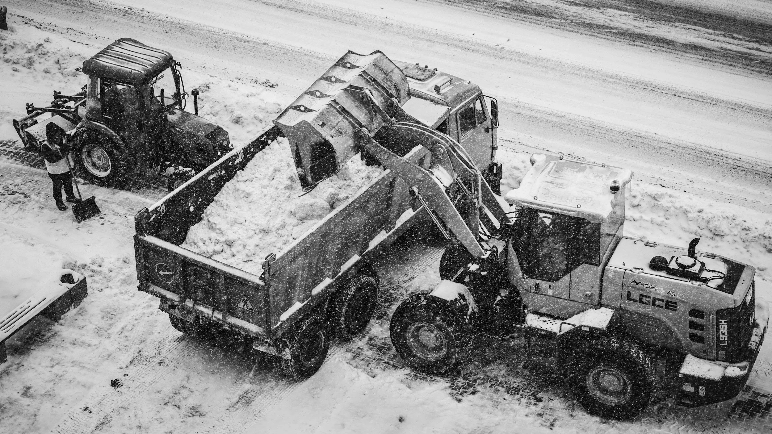
Assets deteriorated. Slopes shifted. Materials moved. Conditions evolved. Crews adapted dynamically in the field.
Reality capture technologies are beginning to close the gap between physical infrastructure and operational awareness.
That includes:
LiDAR
mobile scanning
photogrammetry
drone mapping
digital twins
point cloud modeling
spatial monitoring systems
The implication is not simply better documentation.
It is the emergence of persistent infrastructure visibility.
Measurement Expands Beyond Surveying
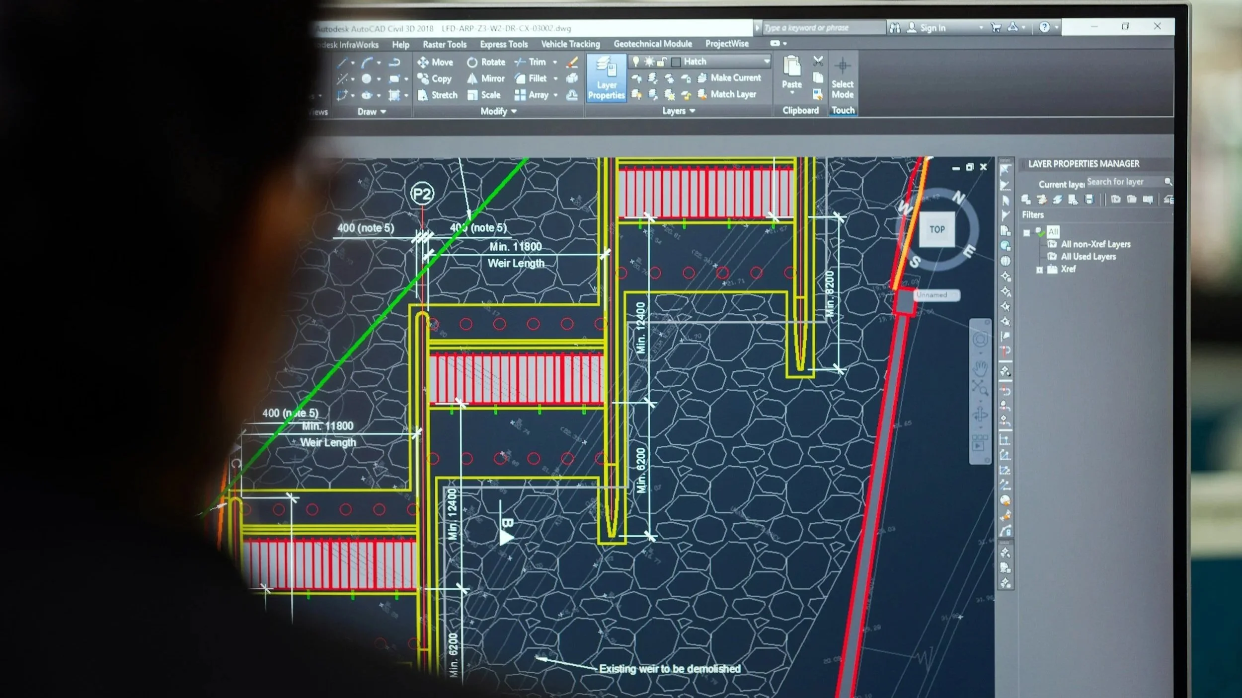
Reality capture is often framed as a surveying or design-support tool.
But operationally, something larger is happening.
Measurement systems are increasingly influencing:
asset management
infrastructure inspections
construction verification
inventory measurement
operational planning
maintenance prioritization
environmental monitoring
Infrastructure systems become fundamentally different once operators can continuously observe conditions spatially instead of relying solely on static reporting cycles.
That changes workflows, changes accountability, and eventually, it changes operational expectations.

Digital Context Changes Operations
Operationally, infrastructure failures often emerge from incomplete context rather than lack of effort.
Crews respond with limited visibility. Materials are estimated instead of measured. Asset conditions are partially understood. Site conditions evolve faster than records can keep pace.
Reality capture systems increasingly reduce those visibility gaps.
Once infrastructure conditions become measurable spatially and repeatedly, operations become less reactive.
Field planning improves.
Verification improves.
Measurement becomes defensible.
Decision-making becomes contextual instead of fragmented.
This is especially important in environments where infrastructure conditions directly affect environmental exposure, material usage, operational risk, or public accountability.
Persistent Visibility Becomes Infrastructure
The long-term shift may ultimately be less about scanning technology and more about operational expectations.
As infrastructure systems become increasingly measurable, organizations will gradually be expected to maintain stronger visibility into:
asset conditions
material movement
operational performance
environmental exposure
infrastructure deterioration
The organizations that adapt best will likely not be those collecting the most data.
They will be the ones capable of converting measurement into operational understanding consistently and practically.
Reality capture is not simply producing better models.
It is gradually turning infrastructure systems into measurable operational environments.


Featured Insights
-
![Image Alt Text]()
From Infrastructure Maintenance routines to Repeatable Process Accountability
Civil infrastructure systems are increasingly expected to explain not only what was done, but how effectively it performed.
-
![]()
Stockpile Measurement best practices are Becoming an Operational Requirement
Handling bulk materials as measurable operational systems rather than static inventory stockpiles
-
![]()
Rules of The Game: Operational Intelligence Systems Within Public Works Departments
Municipal operators expect to balance speed, accountability, environmental exposure, and operational coordination simultaneously
-
![]()
Landscape, hardscape & civil contractors reveal where infrastructure systems evolve
Best practices often emerge through contractor behavior, field adaptation, and installer workflows before they appear in formal infrastructure policy